
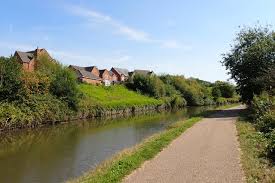
Moorings on the River Stort
Moorings on the River Stort Navigation — 22 km of rural Hertfordshire and Essex river from Bishop's Stortford to the Lee.
Type
River
Region
East of England
Flows through
1 place
Length
23 km (14 miles)
Waterway guide
A closer look at the River Stort
The River Stort Navigation runs 22.5 kilometres from Bishop's Stortford in Hertfordshire south through Sawbridgeworth, Harlow and Roydon to Feildes Weir near Hoddesdon, where it joins the Lee Navigation. Made navigable in 1769 to carry malt and grain to London, it is a narrow, winding, heavily wooded river with 15 locks and a distinctly rural character despite running close to the M11 corridor.
It is widely regarded as one of the prettiest navigations within reach of London: overhanging willows, water meadows, old mills at Sawbridgeworth and Harlow, and abundant kingfishers, herons and swans. Traffic is light compared with the Lee, and the navigation is a dead end, which keeps it quiet.
For boat owners the Stort offers something unusual — genuinely rural long-stay mooring inside the London commuter belt. Marinas and boatyards at Bishop's Stortford, Sawbridgeworth, Harlow Mill and Roydon provide serviced berths at prices below the Lee's London reaches, while the West Anglia rail line runs alongside the river the whole way, with journeys to Liverpool Street of around forty minutes. Stansted Airport is close. The Lee Navigation connection at Feildes Weir opens the route south to the Thames at Limehouse.
Related reading